Volcanic landscapes and sunrise views in East Java’s Tengger Caldera
Gunung Bromo is one of Indonesia’s most iconic volcanoes and forms the dramatic centerpiece of Bromo Tengger Semeru National Park in East Java. Covering roughly 800 square kilometres, the park protects one of the most spectacular volcanic landscapes in Southeast Asia.
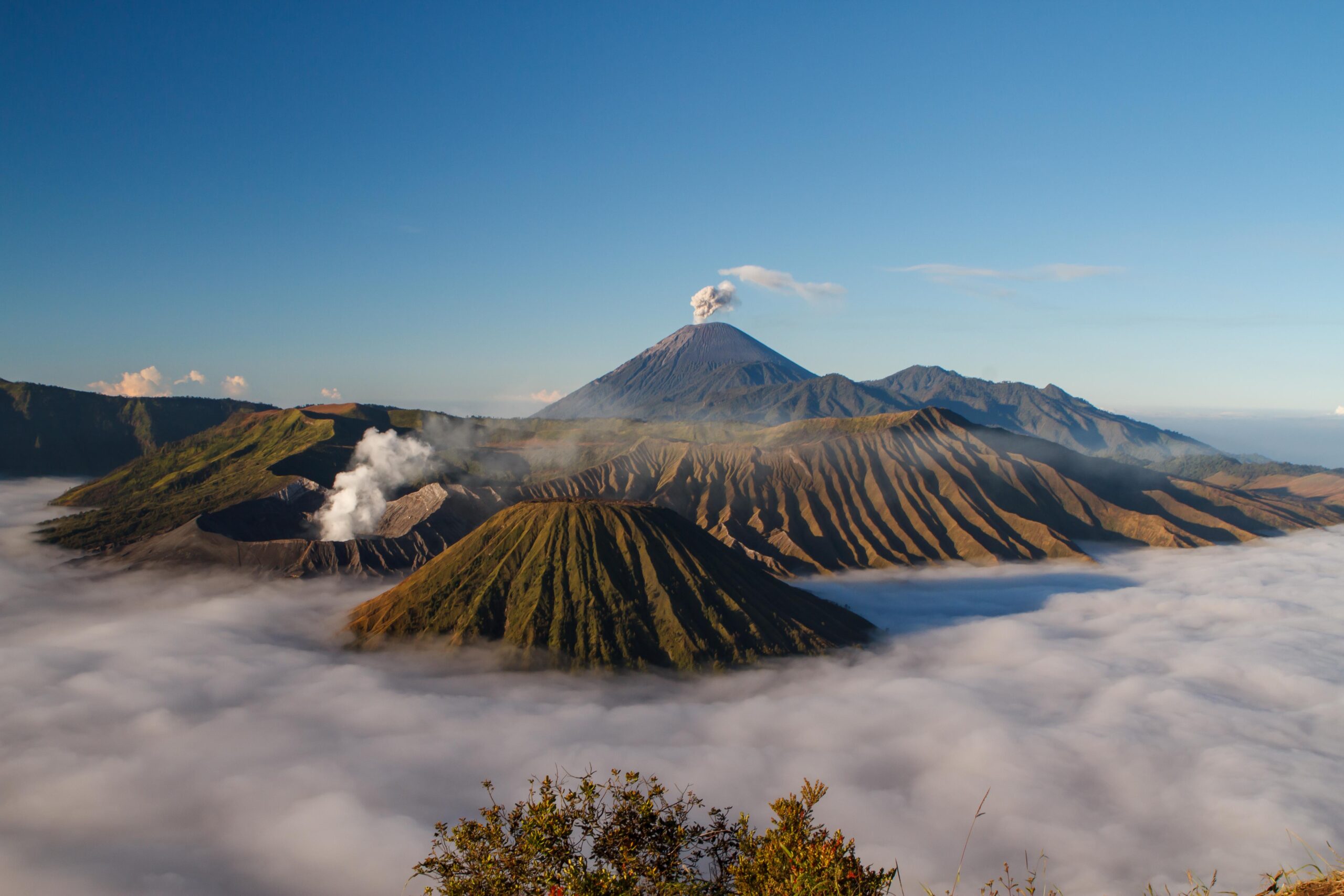
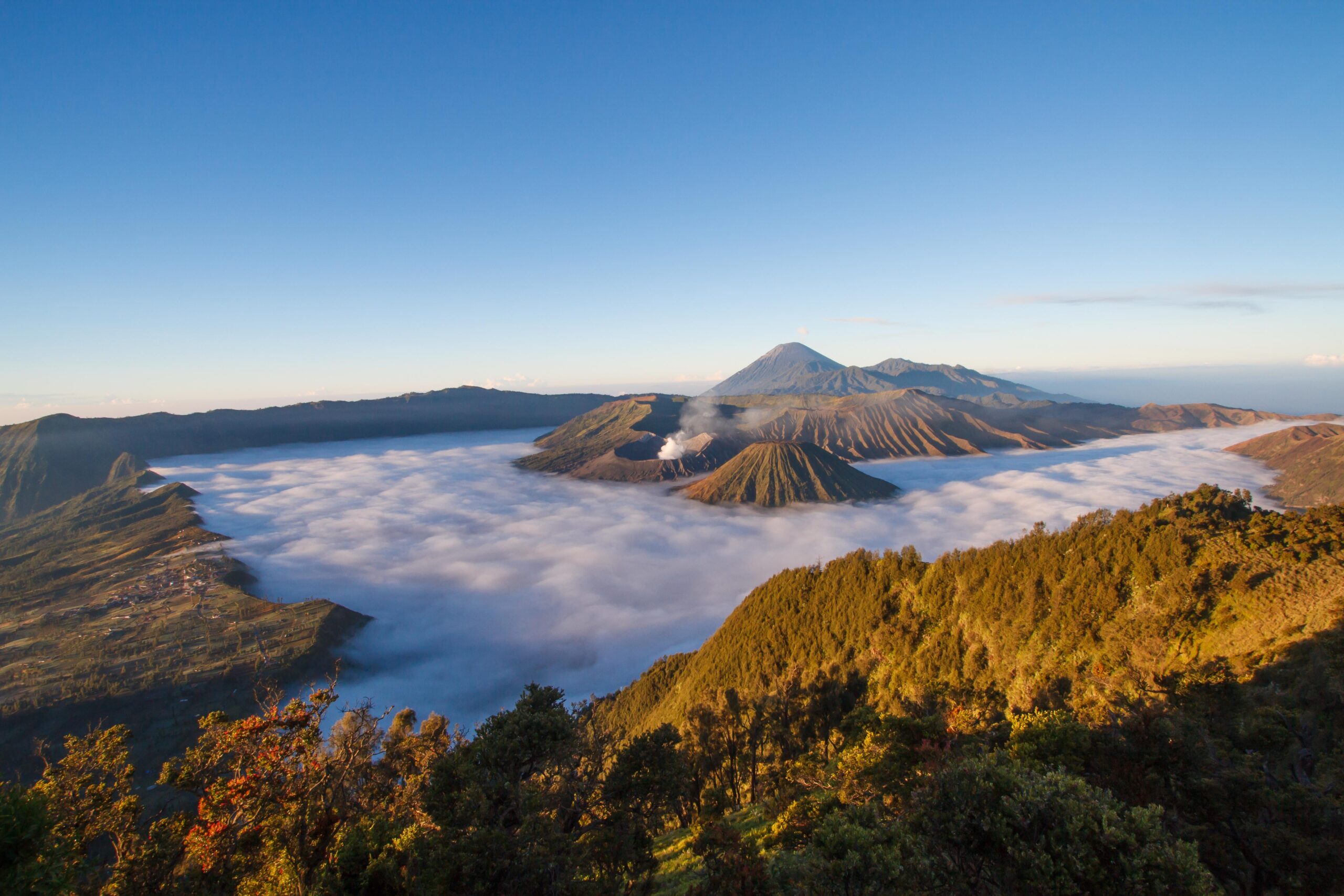
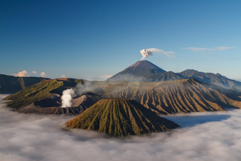
At the heart of the park lies the vast Tengger caldera, the remnant of an ancient volcano. Rising from this enormous crater are several younger volcanic cones, including Mount Bromo (2,329 m) and the perfectly shaped Mount Batok (2,470 m). Dominating the southern skyline is Mount Semeru (3,676 m) — also known as Mahameru — the highest mountain on Java and one of the island’s most active volcanoes.
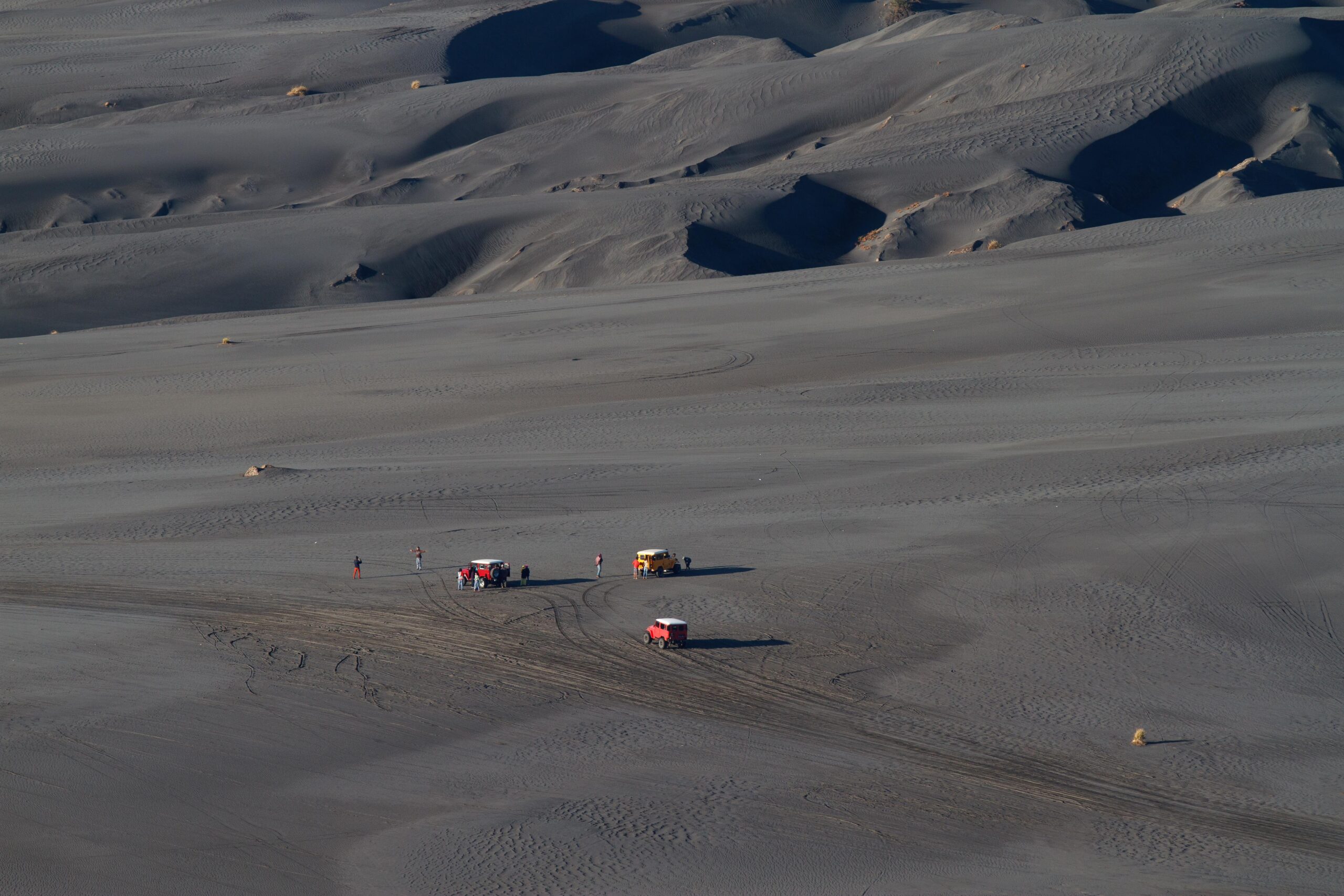
One of the most remarkable features of the caldera is the “Sea of Sand” (Laut Pasir), an immense volcanic plain covering more than 5,000 hectares at an altitude of around 2,100 metres.
The "Sea of Sand", an otherworldly desert-like scenery.
The Tengger Caldera
Inside the vast Tengger caldera five volcanic cones rise from the ash plains:
Mount Bromo (2,329 m)
Mount Batok (2,470 m)
Mount Kursi (2,581 m)
Mount Watangan (2,661 m)
Mount Widodaren (2,650 m)
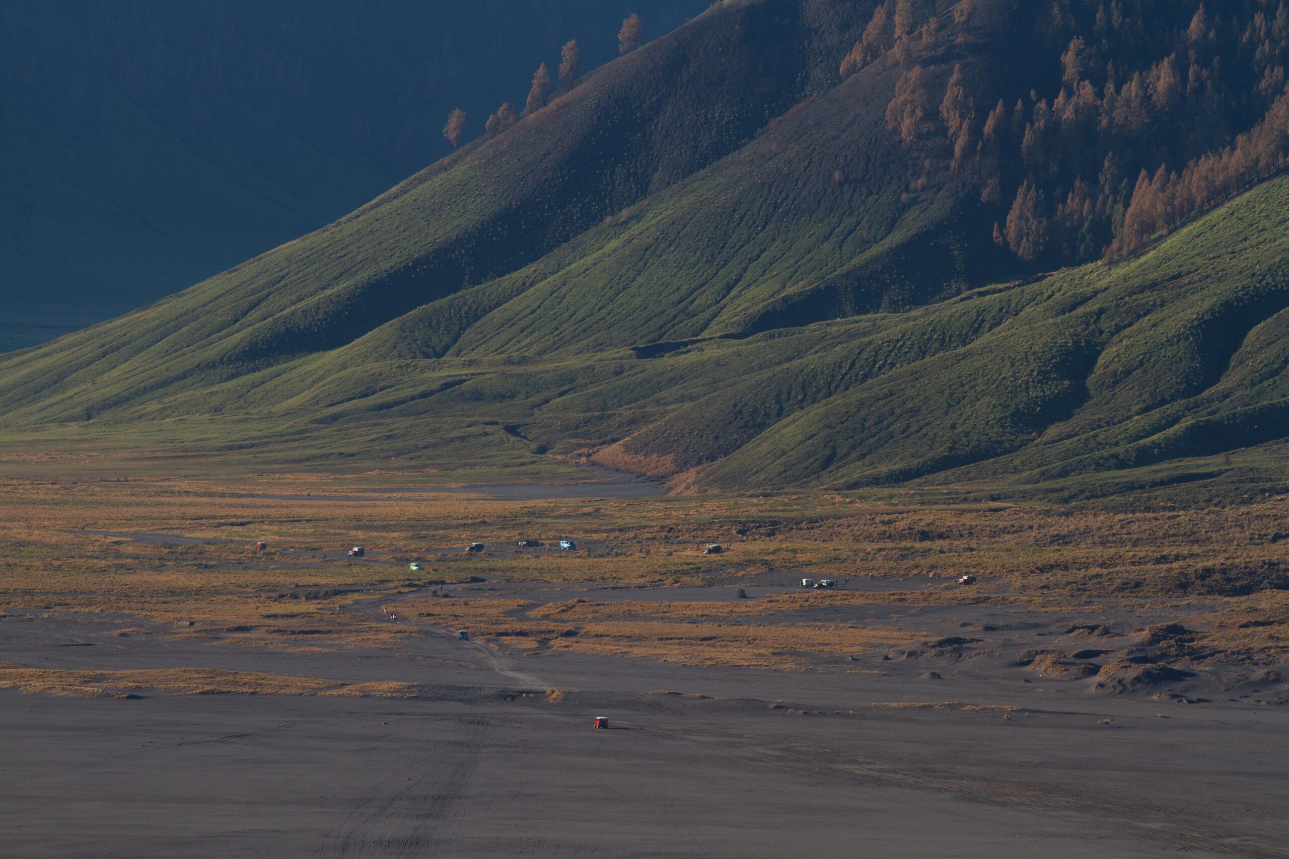
The surrounding landscape feels almost otherworldly. Vast grey ash plains stretch across the caldera floor while volcanic ridges rise sharply from the sand sea.
Mount Bromo’s smoking crater rising above the volcanic plains of the Tengger caldera.
The road across this landscape leads directly toward Mount Bromo, where visitors cross the Sea of Sand before climbing the final staircase to the rim of the crater.
Crossing the Sea of Sand toward Mount Bromo in Bromo Tengger Semeru National Park.
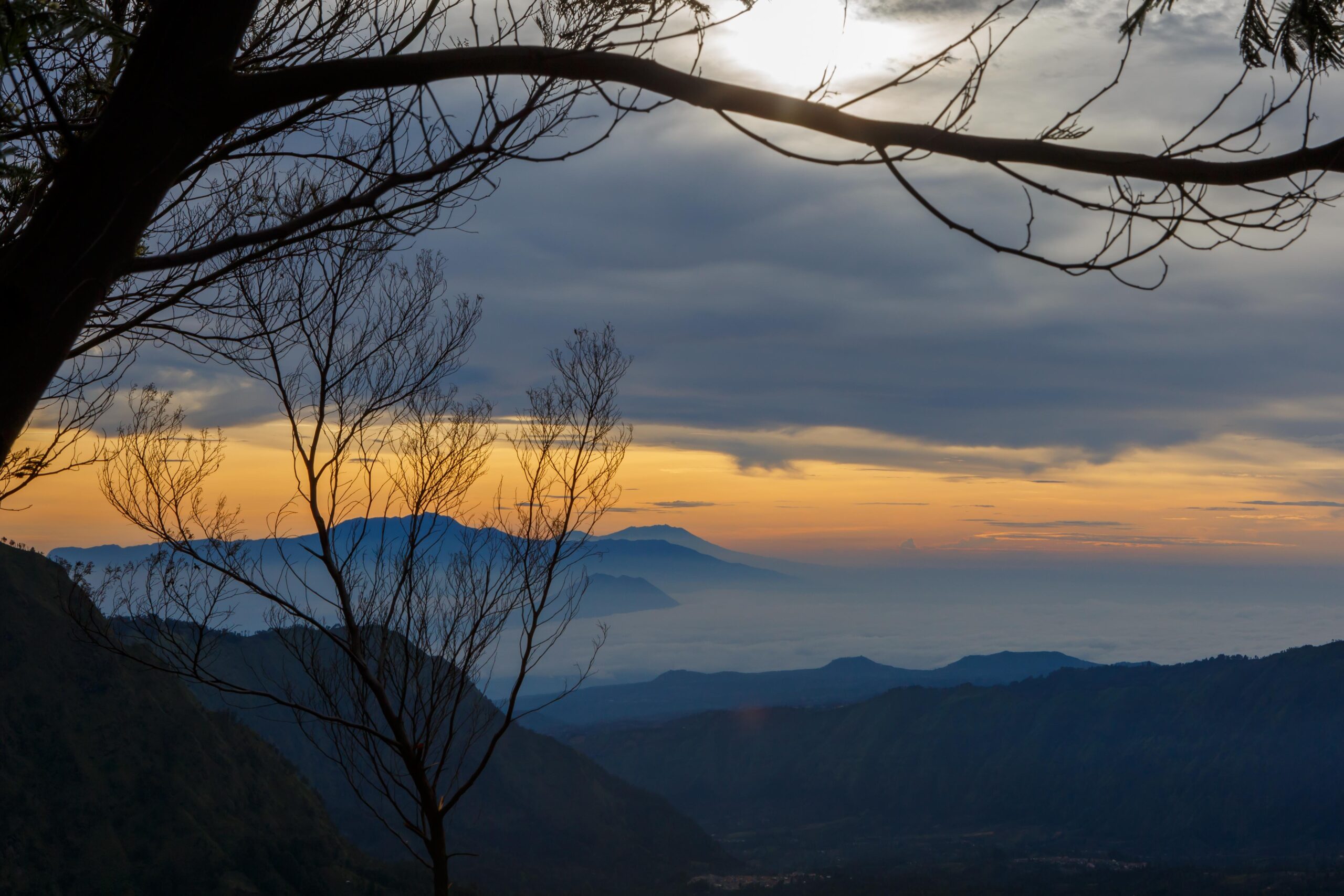
Sunrise at Mount Bromo
One of the most famous experiences in Bromo Tengger Semeru National Park is watching the sunrise over the Tengger caldera. Before dawn, visitors travel across the Sea of Sand to reach the high viewpoints overlooking the volcanic landscape.
The best known viewpoints are located on Mount Penanjakan, where the first light of the day reveals the dramatic alignment of volcanoes across the caldera: the smoking crater of Mount Bromo, the symmetrical cone of Mount Batok, and in the distance the towering Mount Semeru, Java’s highest and most active volcano.
Sunrise over Mount Bromo, Mount Batok and Mount Semeru as seen from the Penanjakan viewpoint.
Two main viewpoints exist:
Penanjakan 1 – closer to the village of Cemoro Lawang
Penanjakan 2 – higher and further away, offering a wider panoramic view
As the sun rises behind the eastern mountains, the volcanic landscape gradually emerges from the darkness, with mist and volcanic ash plains creating one of the most iconic scenes in Indonesia.
View from Penanjakan towards sunrise from behind Gunung Raung and the Kawah Ijen.
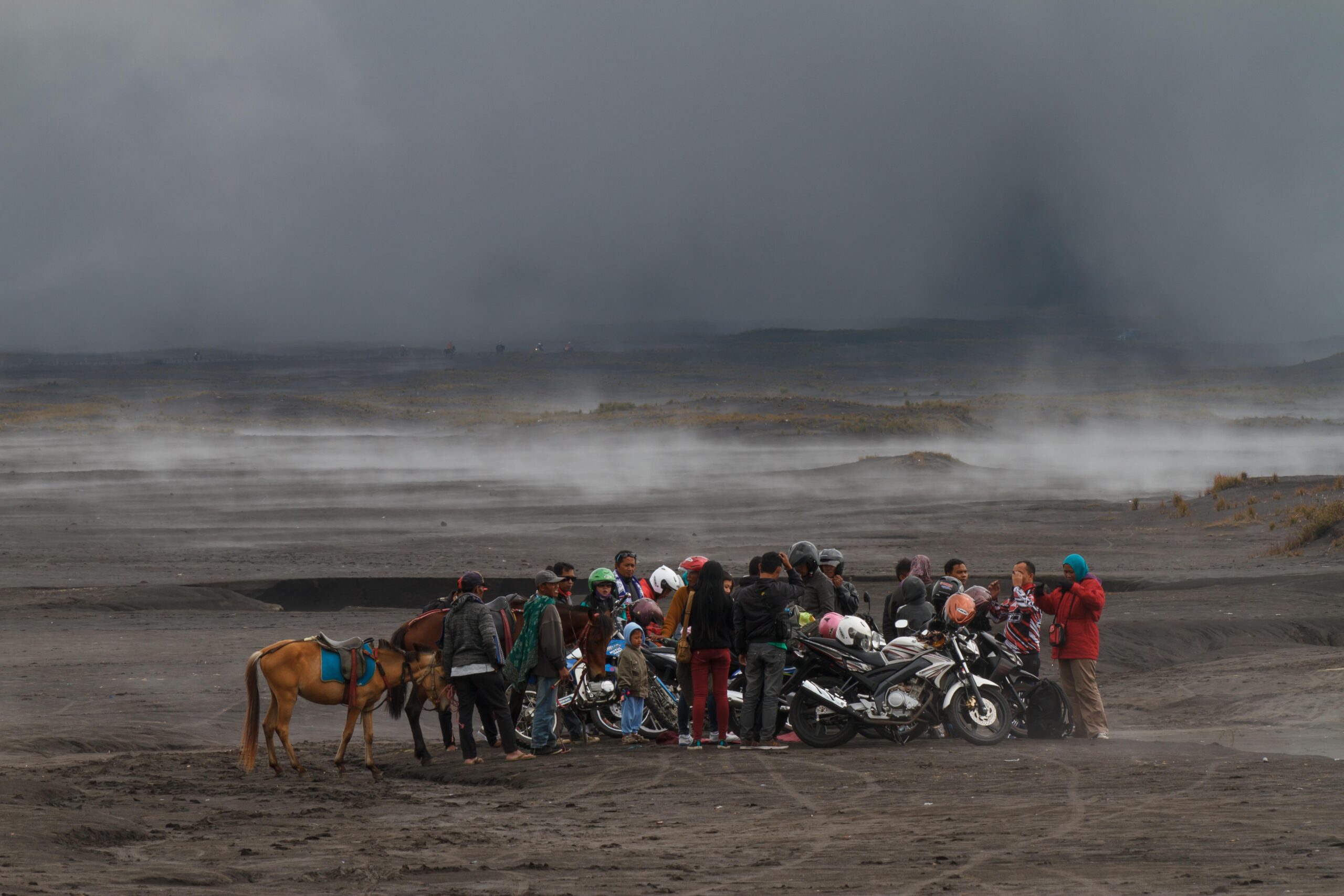
Today most visitors reach the viewpoints by jeep, travelling across the Sea of Sand before dawn. The popularity of these sunrise views can make the area crowded, particularly during weekends and holiday periods.
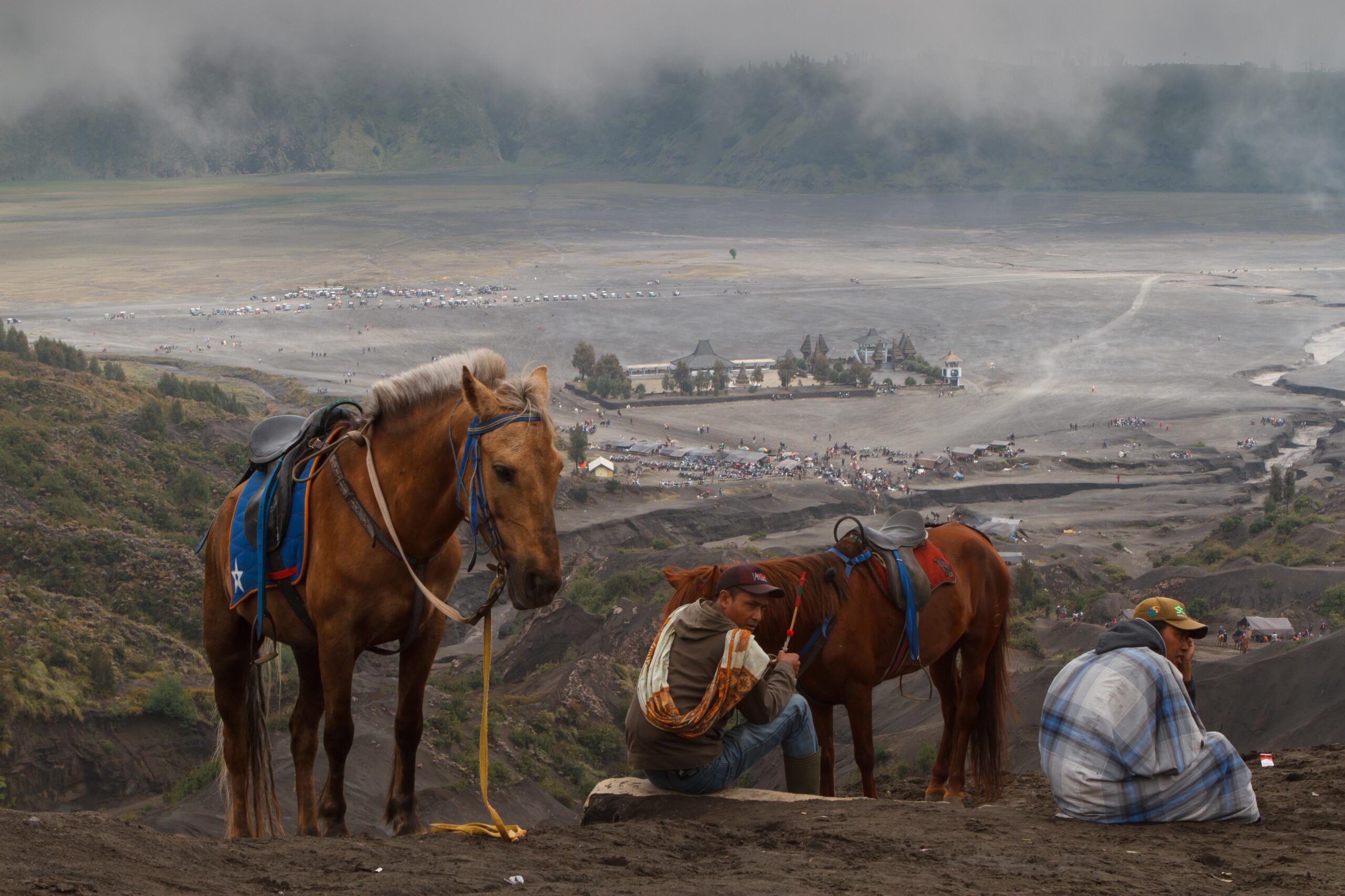
Mount Bromo
Mount Bromo itself is one of the most accessible active volcanoes in Indonesia.
Visitors cross the Sea of Sand before climbing a long staircase that leads to the rim of the crater. From the top, it is possible to look directly into the smoking volcanic vent, where sulphurous fumes constantly rise from the depths of the volcano.
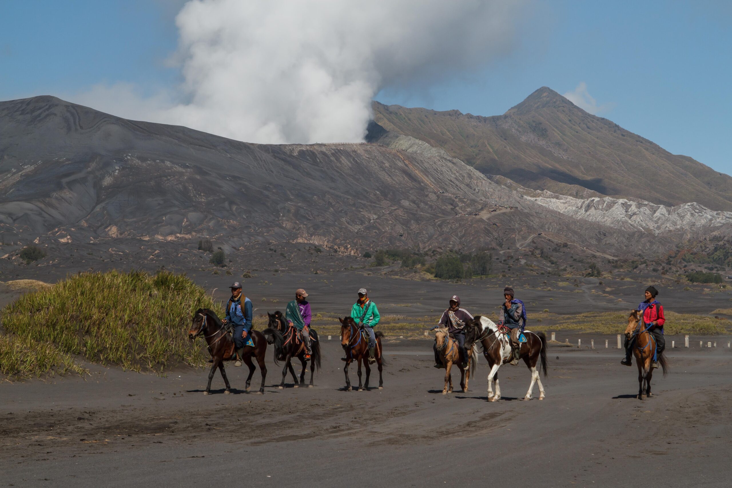
Tengger men with their horses waiting to bring tourists back down from Mount Bromo.
Despite the growing number of visitors, the landscape around Bromo still retains a powerful atmosphere shaped by wind, volcanic ash and the immense scale of the caldera.
The "Sea of Sand" at the edge of the grassy "Teletubbies" hills.
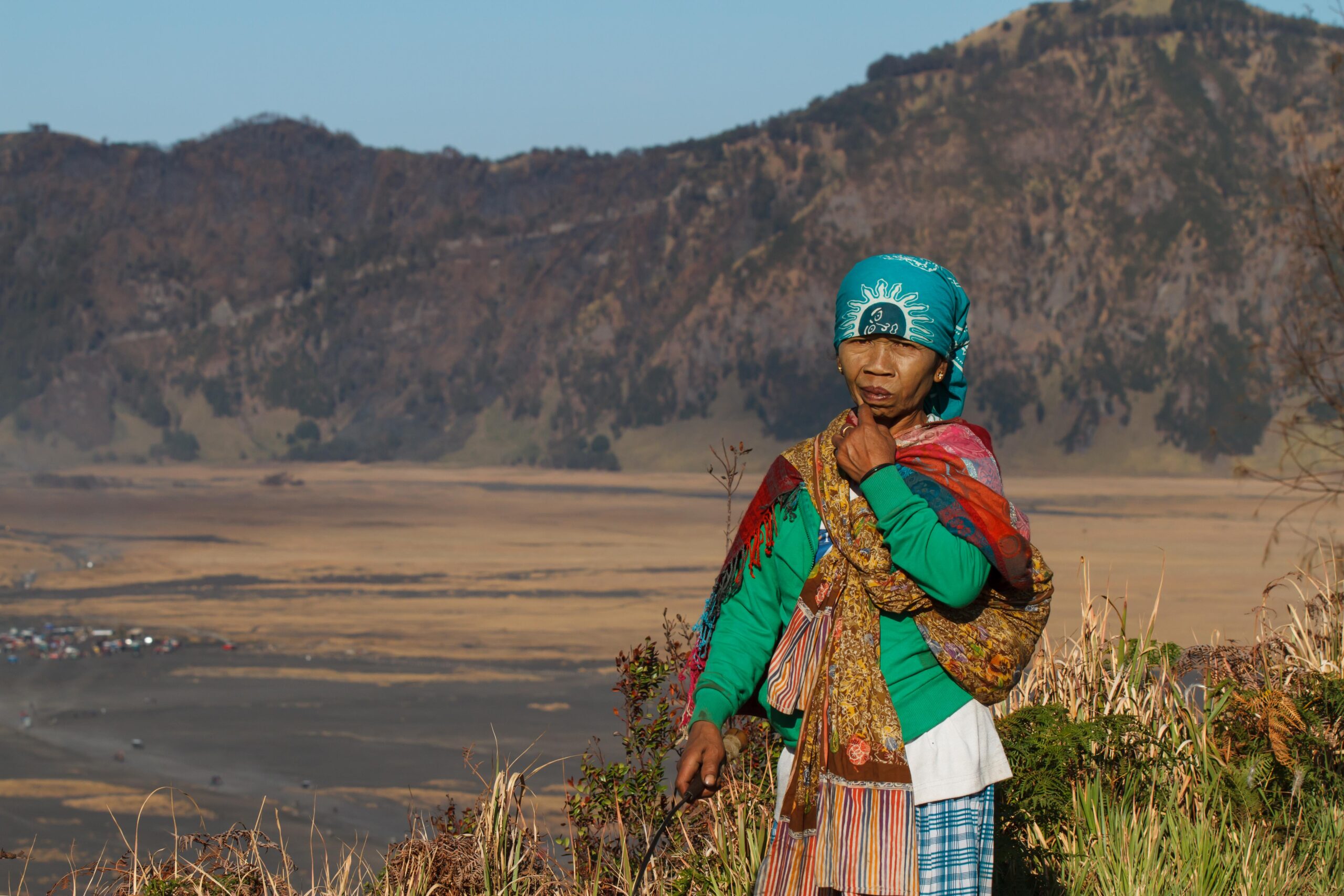
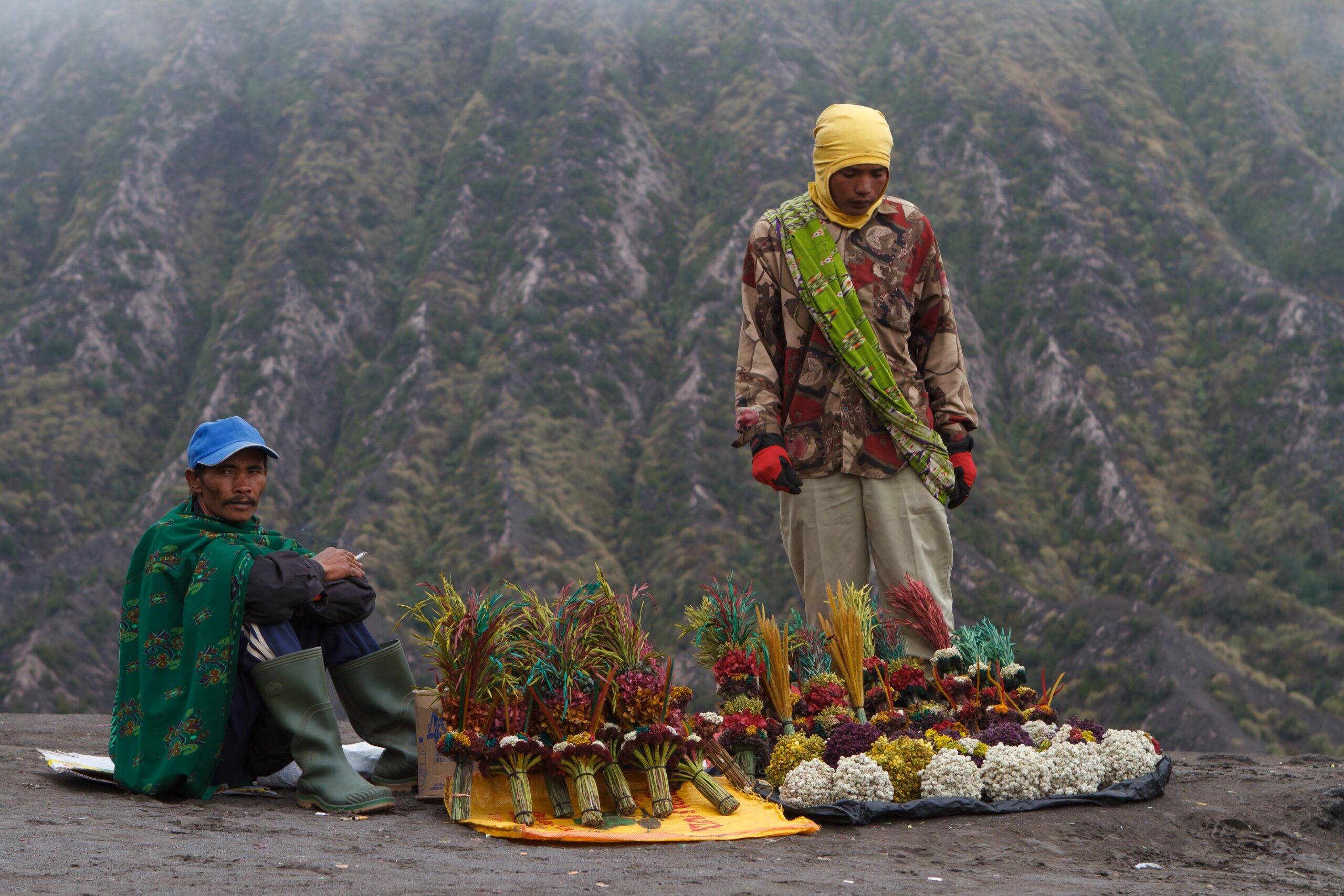
The Tengger People
The highlands around Bromo are home to the Tengger people, one of the few remaining Hindu communities on the island of Java.
Their religion is closely related to Balinese Hinduism but contains strong animist traditions. The Tengger people are believed to be descendants of the Majapahit Empire, the last great Hindu kingdom of Java.
A Tengger woman collecting grass for her horses on the edge of the Tengger caldera.
According to local tradition, when Islam spread across Java centuries ago, many followers of the Majapahit kingdom moved into the remote volcanic highlands where their traditions survived.
Tengger men selling Edelweiss flower bouquets as souvenir.
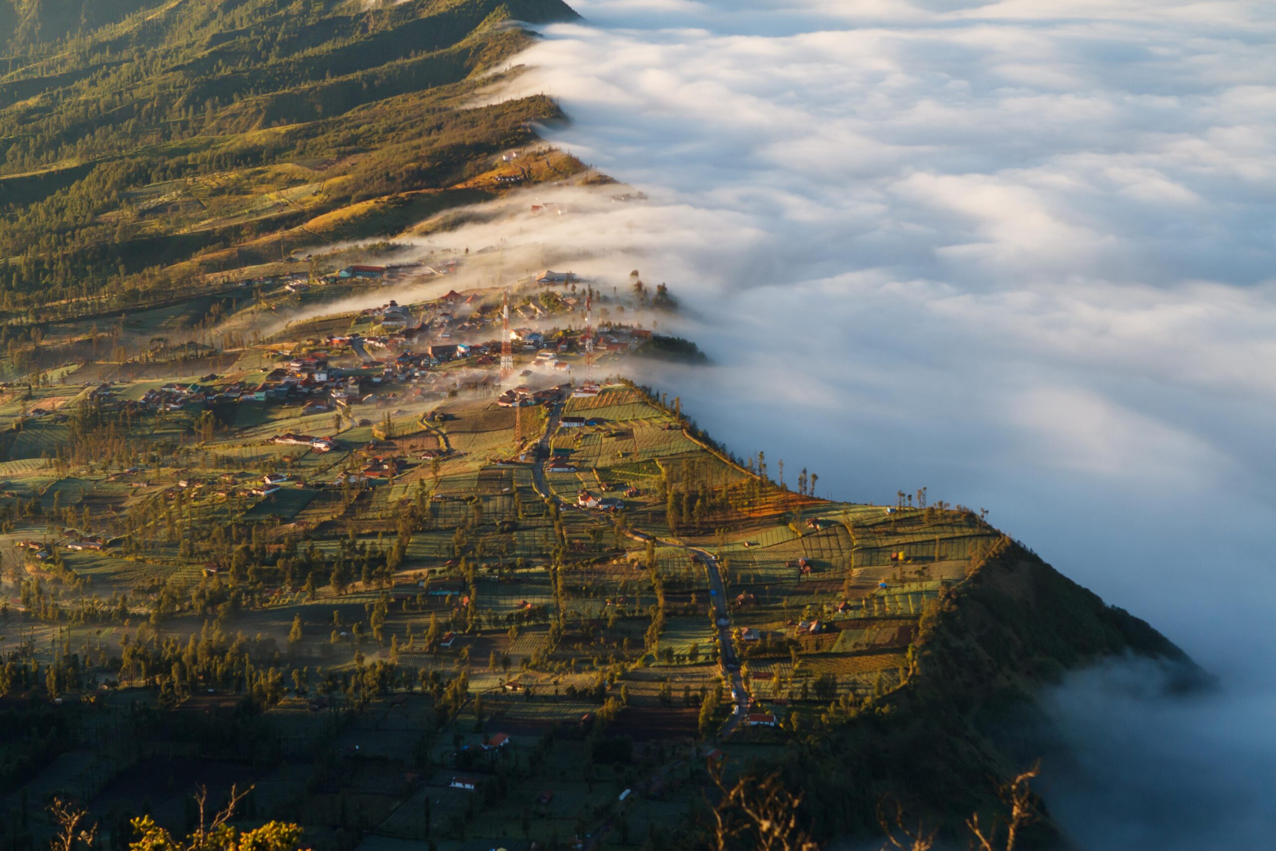
Cemoro Lawang
The village of Cemoro Lawang, located on the rim of the Tengger caldera, is the main gateway to the national park.
Surrounded by steep volcanic slopes, the village sits amidst a patchwork of fertile vegetable fields where local farmers grow crops such as potatoes, cabbage, carrots and onions.
The volcanic soil of the Tengger highlands is exceptionally fertile, and agriculture remains an important part of daily life for the local communities.
Vegetable fields surrounding the Tengger village of Cemoro Lawang on the edge of the caldera.
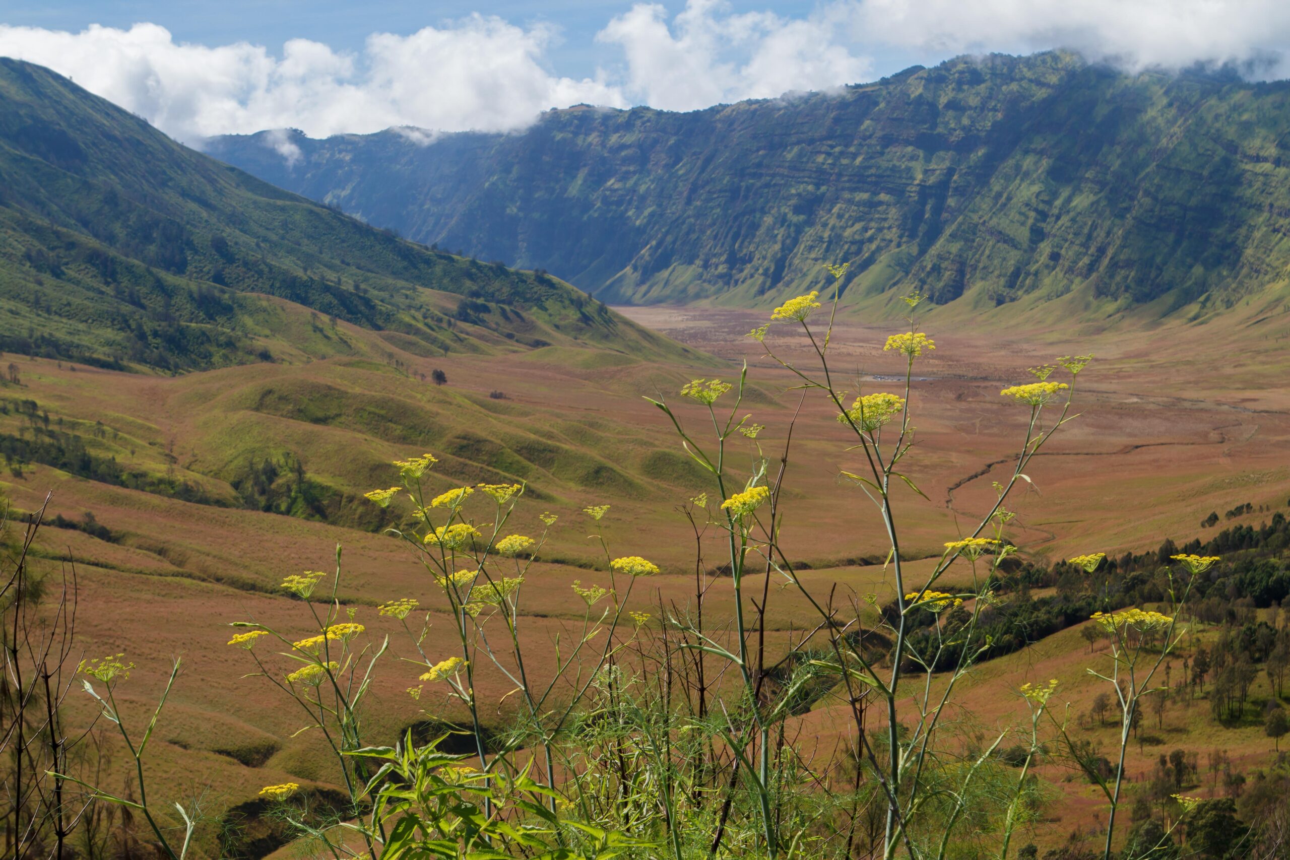
Landscapes of the Caldera
Although Mount Bromo is the most famous feature of the park, the surrounding landscapes are equally remarkable.
The Sea of Sand gradually transitions into grassy savanna landscapes on the southern side of the caldera, where rolling green hills create a striking contrast to the volcanic ash plains.
These hills — sometimes referred to as the “Teletubbies Hills” — form one of the quieter and less visited parts of the national park.
The grassy “Teletubbies” hills, in the southern part of the Tengger caldera.
Other Landscapes of East Java
East Java contains some of the most dramatic landscapes on the island of Java. Active volcanoes rise above vast ash plains, while savannas and tropical forests support diverse wildlife and remote national parks.
Several of these environments are explored through photographic journeys on this site:
Kawah Ijen A striking crater lake known for its turquoise waters and traditional sulfur mining.
Baluran National Park A unique savanna ecosystem often called the “Africa of Java”, where deer, banteng and peafowl roam beneath Mount Baluran.
Meru Betiri National Park A remote rainforest and coastal reserve known for sea turtle nesting beaches.
Alas Purwo National Park One of the oldest protected forests on Java, with monsoon forest, savannas and remote coastal landscapes.
Explore the Photo Gallery
A curated visual collection from Bromo Tengger Semeru National Park – East Java